August 27, 2026
What Caused the recent Flood in Nepal?
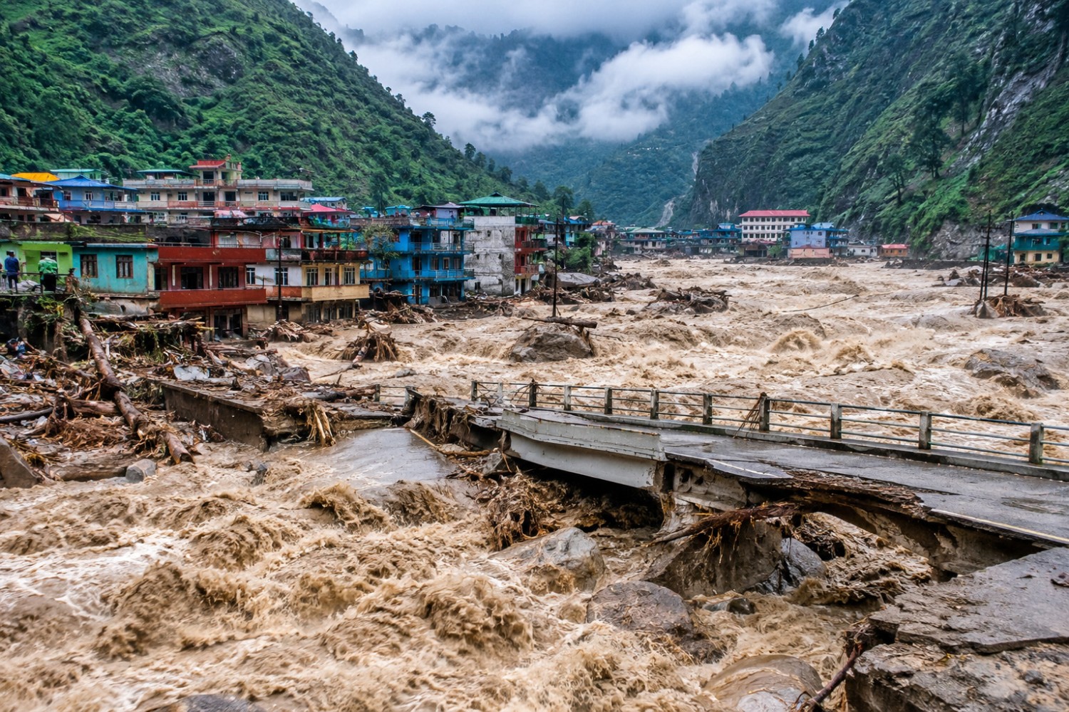
On August 26, 2026, in the early morning at around 8:40 a.m., a disastrous flash flood began to strike the Nepal-China (Tibet) border at Rasuwa Gadhi. The Bhote Koshi River, flowing down from Gyirong town, and the Lhende Stream, flowing from the northern side of Langtang Lirung, meet at this border post.
As a massive landslide and mudflow furiously flowed down the narrow gorge and steep slopes, and swept many towns, settlements, infrastructures, and human lives. There are heartbreaking reports and video clips circulating on social media of the flood.
Originally, it was thought that an earthquake had triggered the landslide that blocked the river, or that a glacial lake had burst, initiating the flood. However, the latest analysis indicates that a huge glacial ice and rock collapse might have occurred in the northern part of Langtang Lirung, 7,234 m (23,711 ft).
After analysis of satellite images and data, National Disaster Risk Reduction and Management Authority of Nepal (NDMMRA) suspects that it was likely a huge glacial collapse or an ice-rock avalanche caused by the sudden break-off of a large chunk of glacier, ice and rock. As per the analysis conducted by the United States Geological Survey (USGS), earthquake like shake measuring approximately 5.2 on the Richter scale was due to the ice-rock avalanche.
What is the Latest Updates from the Flood?
This flood in Nepal not only caused billions in monetary losses, but also left several government officials, foreign tourists visiting Mansarovar-Kailash in Tibet via Nepal, security personnel, workers and staff from dozens of hydropower plants, transport-sector workers, and local residents missing.
The latest report by the NDRRMA and the Prime Minister’s Office (PMO) states that, as of 11:00 a.m. Nepal time (5:15 GMT), 165 bodies had been recovered, and 826 people were missing, including 644 tourists (Nepali and foreign nationals) travelling to Kailash-Mansarovar and Gosainkunda Lake. According to the Nepal Tourism Board (NTB), those tourists reported missing include 178 Indian nationals, 127 Nepali nationals, 65 from the USA, 53 from Ukraine, 51 from Malaysia, 35 from Australia, 27 from Canada, and others.
Seventy-three people were injured and receiving medical treatment at various hospitals, while 7,451 security personnel had been deployed for search and rescue operations. The government has dispatched large quantities of relief materials and is working very seriously to assist the affected people.
China also reported three deaths and 558 people missing due to the flood in and around the border office area.
All these numbers are based on initial reports and do not represent the final figures. As telephone connections, internet services, and electricity have been almost completely cut off, rescue and recovery efforts are still underway. We hope that as many people as possible will be found safe.
Where Were the Major Impacts of the Flood on Trails and Infrastructure?
The mudslide and flood originated in the Lhende Khola and first hit the Nepal-China border posts on both sides, including the connecting bridge. The catastrophic flood then swept through towns such as Rasuwa Gadhi, Timure, Syabru Bensi, Malilung, and Betrawati in Rasuwa District. Further downstream, the flood swept through and damaged towns such as Trishuli Bazar, Battar, and other areas.
The Department of Roads, Nepal states that 32 bridges were completely destroyed, disrupting connections for people in Dhading, Nuwakot, Rasuwa, and Gorkha districts. More than 40 kilometers of road have been completely damaged along the Syabrubensi–Rasuwagadhi section.
The flood, though not very severe, has flowed all the way through the Narayani River in the Terai and then into India.
The trip to Kailash-Mansarovar via Nepal has been the most affected, as roads, bridges, and other infrastructure have been severely damaged or destroyed. The road to Dhunche via Trishuli and Syabrubesi has also been affected, and trekking in the Langtang region will be difficult for a few weeks.
Are Satori Adventures’ Autumn Expeditions and Treks Affected by the Floods?
Shishapangma, Cho Oyu, and Everest North Face expeditions are currently not permitted by the Chinese authorities. Therefore, Satori Adventures does not have any expedition groups operating there at this time.
The river valley and highway affected by the flood are in the Langtang region. However, we do not have any major expedition programs for peaks such as Yala Peak, Naya Kanga, or Langtang Lirung in that area.
Our expeditions to Chulu Far East and Chulu West are already in progress, and our teams are currently in the mountains, which have not been affected by this flood. Some of our Manaslu Expedition team members are also on their way to the Peak. And, we are using the best possible and safe route to the mountain.
The highway to Besishahar goes, access to Mt. Manaslu, Himlung Himal, and other peaks, via some affected parts along the Trishuli river bank. And, in couple of days the highway will be in operation according to the government authorities.
Conclusion:
We are eager to welcome you all for the coming Autumn season to take part in various activities in the Nepal Himalayas as you have planned. Our confirmed trips are all in safe and unaffected regions. As you are all aware, natural disasters are unpredictable, and in recent years, it has become even more difficult to predict the weather. With our long experience, expertise, and professionalism, we will try our best to make your trip a smooth and memorable experience.